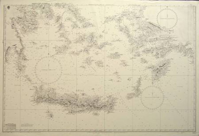
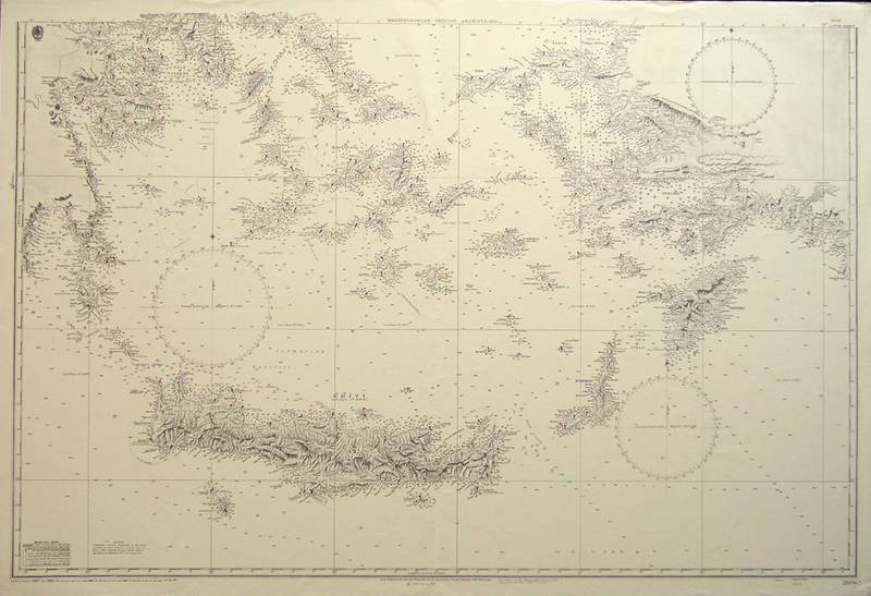
Grecian Archipelago - Mediterranean - BRITISH ADMIRALTY
BRITISH ADMIRALTY “Mediterranean. Grecian Archipelago.” London 1863. (updated to 1966.) B/W. 26X39.
Splendid chart shows the Grecian coastal regions with islands from Athens & Salamis Bay down to the island of Kriti (Crete) which is depicted in large scale. Includes the Cyclades and the coast of Turkey with the Dodecanese Islands, Scarpanto and Rhodes. Hundreds of depth soundings in fathoms are depicted offshore and around the islands and the chart has both topographical and hydrographical details. Fine.
In June, 2004, Cartography collectors could purchase Chart #2836, for as little as US$125, from: