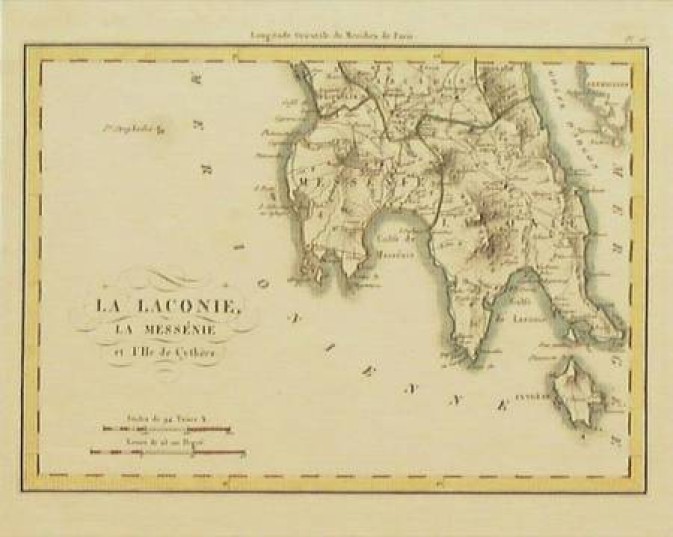
“La Laconie, La Messénie et L'Ile de Cythère” Paris c. 1820 - attributed to R. Lapie
R. LAPIE (Attributed) “La Laconie, La Messénie et L'Ile de Cythère” Paris c. 1820. Colored. 6X8¼.
Attractive small chart of the southern end of the Peloponnesos (Greece) and below it the island of Cythère, (Kythera). Depicts the Gulf of Laconia & the Gulf of Messina. The city of Sparte and Mt. Menelaion; Megalopolis, Triphylie & the Gulf of Argon (Argolis).
In June, 2004, Cartography collectors could purchase Chart #GR116, for as little as US$175, from: