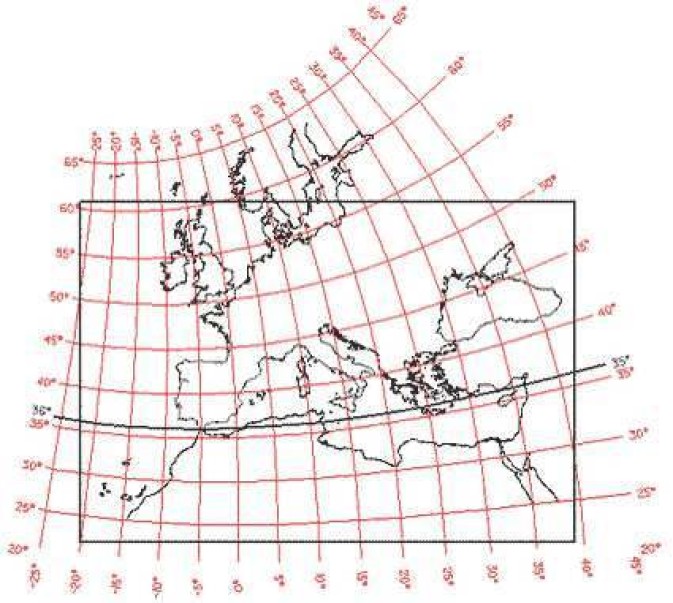
Map 5. Assigning map projections to portolan maps.
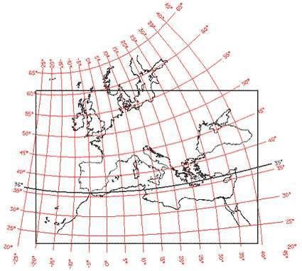
Figure 5. Europe and the Mediterranean Sea are represented in the oblique conic projection (in red) as well as the frame of Sideri’s map (in black), after the fitting. The comparison with Fig. 1 confirms the proper choice of this projection.