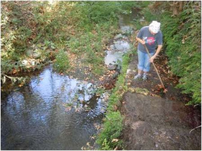
Cleaning the watercourse just below the Keramari spring
Environmental Archaeology and History in Northern Kythera: The Karavas Water Project
Timothy E. Gregory (Ohio State University)
Lita Tzortzopoulou-Gregory (Ohio State University)
Download a .pdf version of this article here:
Gregory_karavas_water_kythera_summer_2013.pdf
The Karavas Water Project is an example of a new kind of history that seeks to learn from the past in order to maintain the beauty and the richness of small-scale eco-niches. The project is based on the recognition that the area of Karavas (in the northern part of Kythera) is known for its plentiful springs and deep green gorges that create an environment that more resembles a sub-tropical rain forest than it does the parched landscape of many parts of Greece. The project has as its goal the detailed exploration and recording of the main Karavas watershed that runs in a generally southwest-northeast direction from the heights near Gerakari to the sea at Plateia Ammos. The research includes the basic mapping of the area and the identification of the many natural and humanly modified springs, as well as the water devices that were constructed to convey and store the water and to utilize water for a variety of purposes, including irrigation and power, most notably the water mills that still mark the sides of the watershed at various points.
The Keramari Mill below Diakopoulianika
A major consideration of the project is the broader realization that natural resources in particular areas often allow small or even isolated societies, over the centuries, to develop systems of production and exchange so that they can survive, frequently despite political, military, or even significant economic shifts. Indeed, many localities in Kythera, such as Karavas, were able to develop and prosper, change their means of subsistence, and survive – at least until modern times. Thus, the Kythera Water Project uses an environmental approach to examine the interactions between resources and production in order to understand better the systems of interaction that lay behind the prosperity and resilience of local society in the past, hopefully as a clue to imagine similar survival there, and in many other areas, into the future.
The “picnic area” at the Manganou spring, after being cleared in 2011
Chronologically, the project begins most naturally, with the “present,” meaning the location, condition, size, characteristics, and use of these elements as they are now. We then seek to push our research back into the past, using, first of all the characteristics of the humanly-made structures, their chronological elements and what we can say of their change over time. In addition, we make significant use of oral information, which many inhabitants of Karavas or Kytherians living elsewhere have provided, to help us understand the use of water and water power back into the more distant past. Beyond this, we have begun an examination of documents in the Kythera Historical Archive since these include contracts, wills, and agreements that not uncommonly mention places and even specific buildings that are of importance in our present study. Finally, although the project is not formally archaeological in nature, we realize that many of the resources that we have identified would also have been of use in the much more distant past and that, on some occasions, we can hypothesize how they might have been used in the past. Thus, it may not be an accident that one of the already known tombs of prehistoric date in the Karavas area is located very close to some of the more impressive cistern systems we explored. Although those cisterns, which are still being used, are modern in their present form, it is not impossible that they had also been used by individuals living in the prehistoric settlement that must have been located nearby.
Students clearing undergrowth at the Manganou Spring, Karavas
Our fieldwork over the past two years was carried out with the assistance of students from the Ohio State University (USA), who volunteered to help us clear many of the watercourses, springs, and watermills that had become nearly completely impassable, covered over with a thick covering of thorny vines and other unpleasant vegetation. Despite uncountable scrapes and punctures, torn clothes and ripped boots, and many falls into the cold Karavas water, these students opened many passageways and cleared several springs, allowing us to examine in detail some of the facilities that were built to move, store, and use water over the centuries. As a result, we are beginning to see how people in the past were able to preserve and maintain the natural resources on which their livelihood depended, in part as an important lesson for us today.
In addition, the gorges around Karavas are a beautiful retreat, where visitors can enjoy the wonders of nature, the coldness of the clear water, and the works of human activity for centuries on end. We hope that visitors and local people will do their best to keep the streams and paths of the Karavas area clean and open, so all will be able to enjoy them.
A waterfall near the Portokalia spring
You can contact us at : Tim Gregory and / or Lita Tzortzopoulou-Gregory, or 07360-33565.
