submitted by Chrysoula Boutoura on 27.08.2006
Figure 7. Olliva's map associated to the oblique conic projection and the protocol in Fig. 4. Figure 4 See the entire article: Assigning map projections to portolan maps
submitted by Chrysoula Boutoura on 26.08.2006
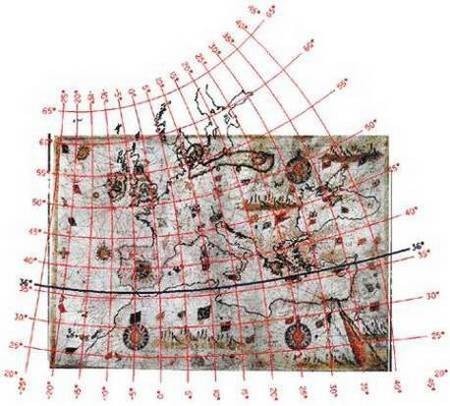
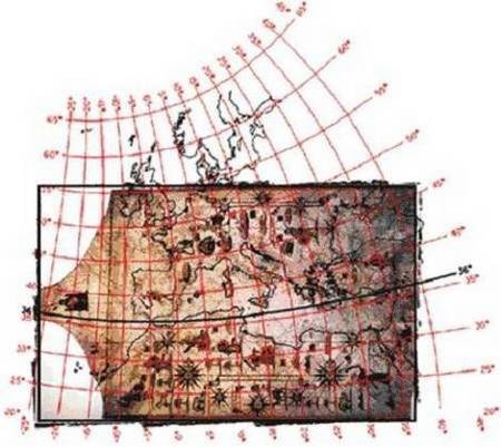
Figure 6. Sideri’s map associated to the oblique conic projection and the protocol in Fig. 4. Figure 4 See the entire article: Assigning map projections to portolan maps
Figure 5. Europe and the Mediterranean Sea are represented in the oblique conic projection (in red) as well as the frame of Sideri’s map (in black), after the fitting. The comparison with Fig. 1 confirms the proper choice of this projection. See the entire article: Assigning
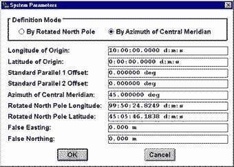
Figure 4. The projection parameters protocol. See the entire article: Assigning map projections to portolan maps
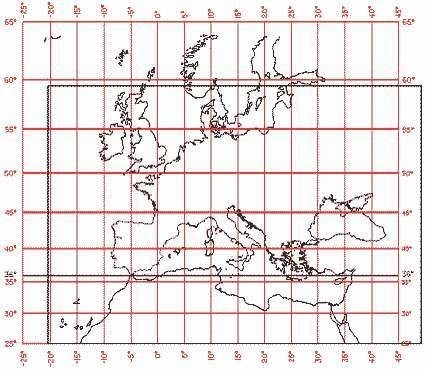
Figure 3. The normal cylindrical projection (in red). The frame of the portolan-map (in black) is oriented with the left side parallel to the Atlantic Iberian coasts. See the entire article: Assigning map projections to portolan maps
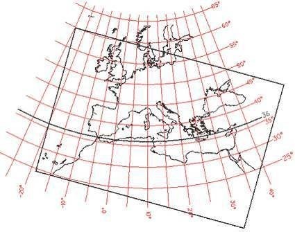
Figure 2. The normal conic projection (in red). The frame of the portolan-map (in black) is oriented with the left side parallel to the Atlantic Iberian coasts. See the entire article: Assigning map projections to portolan maps
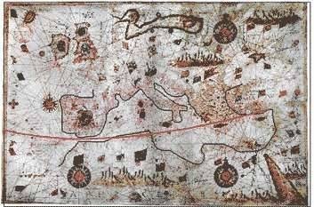
Chryssoula Boutoura* e-Perimetron, Vol.1, No. 1, Winter 2006 [40-50] www.maplibrary.gr/e_perimetron | ISSN 1790-3769 Assigning map projections to portolan maps Keywords: Late medieval and renaissance cartography; nautical maps; map projections; history of cartography; map analysis; map comparison; raster map processing. Summary In spite of the widely spread impression that the portolan-maps are projection-less, ...
submitted by James Victor Prineas on 19.03.2006
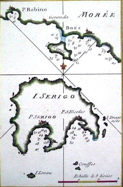
Recueil des Principaux Plans des Ports et Rades de la Mer Mediterranée..., 1779
submitted by James Victor Prineas on 02.03.2006
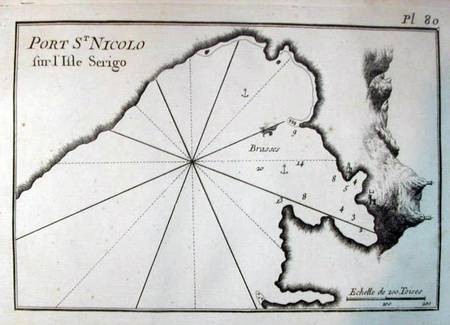
Date: 1764 taken from: Joseph Roux, Recueil des principaux plans des ports et rades de la Mer Mediterranee, Marseille 1764
submitted by - AAIAA - on 22.02.2006
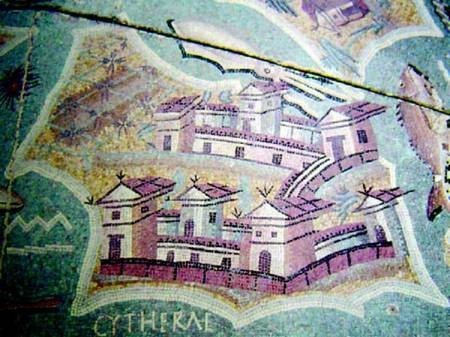
From the Invitation to the Stavros Paspalas Lecture on Archaeological Research on Kythera. Lecture entitled: Kythera: A Mediterranean Island Through Time. The island of Kythera, best known for its mythological and literary associations with Aphrodite, lies between southern Greece and Crete, and on the western threshold of the Aegean Sea. Its nodal position as regards seafaring and communication networks was well noted throughout Antiquity and ...
submitted by James Victor Prineas on 01.01.2007
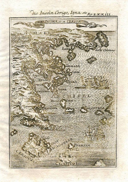
1683 Map of CERIGO Kithira Island 1st ed. by Allain Manesson Mallet
submitted by James Victor Prineas on 07.10.2005
Engraved map, printed ca. 1650. 11 x 6.5 cm.
submitted by James Victor Prineas on 08.08.2005
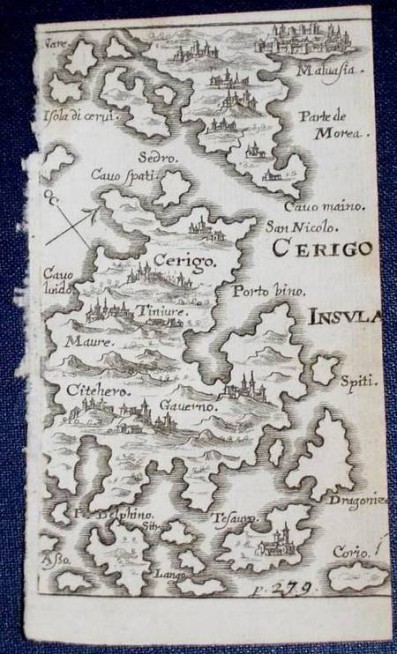
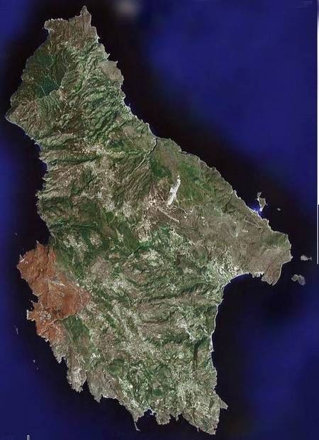
I know this category is called "Vintage Maps" but this satellite picture is so beautiful that, for lack of anywhere better to put it, I'll dare to place it here. Note the prominence of the huge airport which, I am told, is 4 times bigger than it needed to be for civilian flights because NATO saw the island in a strategic position between Europe and the Middle East.
submitted by Stephen Samios on 04.03.2005
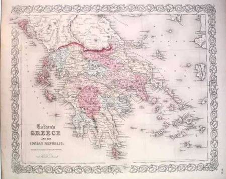
Classic Colton treatment in this attractive steel plate map of the region. Original hand color distinguishes regional boundaries. From: http://www.antique-atlas.co.uk/greece.html
submitted by Site Administrator on 25.09.2004
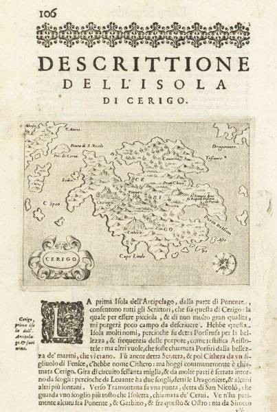
Map of the island of Cerigo, the southernmost Ionian Island, Cythera (Greek:Kythera). Copper plate engraved map on a page from atlas of Tomaso Porcacchi, Isole del Mondo published in Padua c1585. Relevant text in Italian below the image. 10x13.7cm (4x5 3/8"). Atlas page measures 33x21cm (11 7/8x 8 1/4"). An enlargement of the map on this page was submitted as an earler map in this section - click page 2 at the bottom of this page to find it.
submitted by George Poulos on 14.06.2004
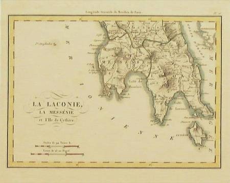
R. LAPIE (Attributed) “La Laconie, La Messénie et L'Ile de Cythère” Paris c. 1820. Colored. 6X8¼. Attractive small chart of the southern end of the Peloponnesos (Greece) and below it the island of Cythère, (Kythera). Depicts the Gulf of Laconia & the Gulf of Messina. The city of Sparte and Mt. Menelaion; Megalopolis, Triphylie & the Gulf of Argon (Argolis). In June, 2004, Cartography collectors could purchase Chart #GR116, for as little as US$175, from:
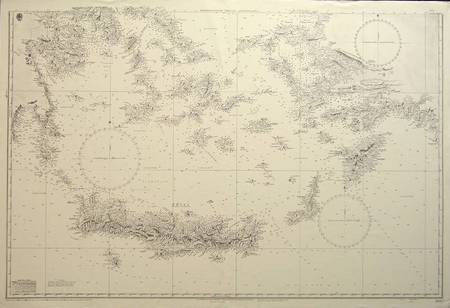
BRITISH ADMIRALTY “Mediterranean. Grecian Archipelago.” London 1863. (updated to 1966.) B/W. 26X39. Splendid chart shows the Grecian coastal regions with islands from Athens & Salamis Bay down to the island of Kriti (Crete) which is depicted in large scale. Includes the Cyclades and the coast of Turkey with the Dodecanese Islands, Scarpanto and Rhodes. Hundreds of depth soundings in fathoms are depicted offshore and around the islands and the chart has both topographical and hydrographical ...
submitted by George Poulos on 28.04.2004
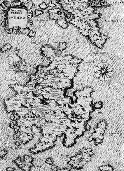
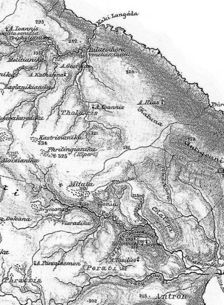
Kythera, ca. 16th century. From, The Island of Kythera: A social history, George. Leontsinis. There are a number of other vintage maps of Kythera re-produced in this superior and important history of Kythera.
submitted by Site Administrator on 02.06.2003
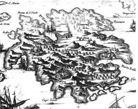
Map from 1690 by Olfert Dapper, a dutch doctor who was much interested in far away lands and who was part of the second and third Dutch expeditions to China.
submitted by James Prineas on 01.06.2003
Dr. Richard Leonard 1899.
Hi Harold (distant cousin!) Vikki is correct. Velio married Angelo Chlentzos 'Bylos' on 30 Aug 1923 in...
Hi Harold, You should be able to connect with many of your relatives here and on Kythera...
My wife and I intend to visit Kythera from Australia in August 2024. We hope to see...
This is a section of a set of maps of the Ionian Islands, item ref: MR 1/2037/48 held at the...
About 5 minutes into the program Ada Margariti, who is an Attorney at Law, speaks about how she came to...
Interviewed during his visit to Australia, 2013.
August 17, 2010 103.2 HOPE - radio station You’ve heard of PhDs in science, medicine and education but have you...
Brisbane kytherians at paliochora excursion ..exploring the wonderful site and seeing all the churches .. this one is called ' e...
Gorgeous Ruby! Ruby's father was Evangelo Megaloconomos born 7 September 1891, died 29 January 1983 Ruby was born 16 September...
26.11.2023 (Message Board)
23.11.2023 (Message Board)
27.09.2023 (Message Board)
Hi Maria (and Nick), I know where his family fits in on our tree. I'll be setting...